We will guide you through RSI
Predicting slippery conditions is difficult, and taking the right action at the right time without either doing too much or too little is even more difficult. RSI provides emergency preparedness managers with the best available information on future road status and relevant actions to make the right decision.
Emergency preparedness managers, who must take decisions about such actions, have a number of difficult assessments and factors to weigh up, and making the best possible decisions requires the right tools. RSI gives users access to one of the world’s most advanced forecasts of slippery conditions.
All RSI users receive a detailed forecast of how the weather will affect the road status over the next 24 hours. An advanced mix of different types of input data from weather stations, gritters, weather radar, mobile road status measurements and weather forecasts enables Klimator to predict road status with a high degree of accuracy and provide relevant recommendations for action.
A quick check.
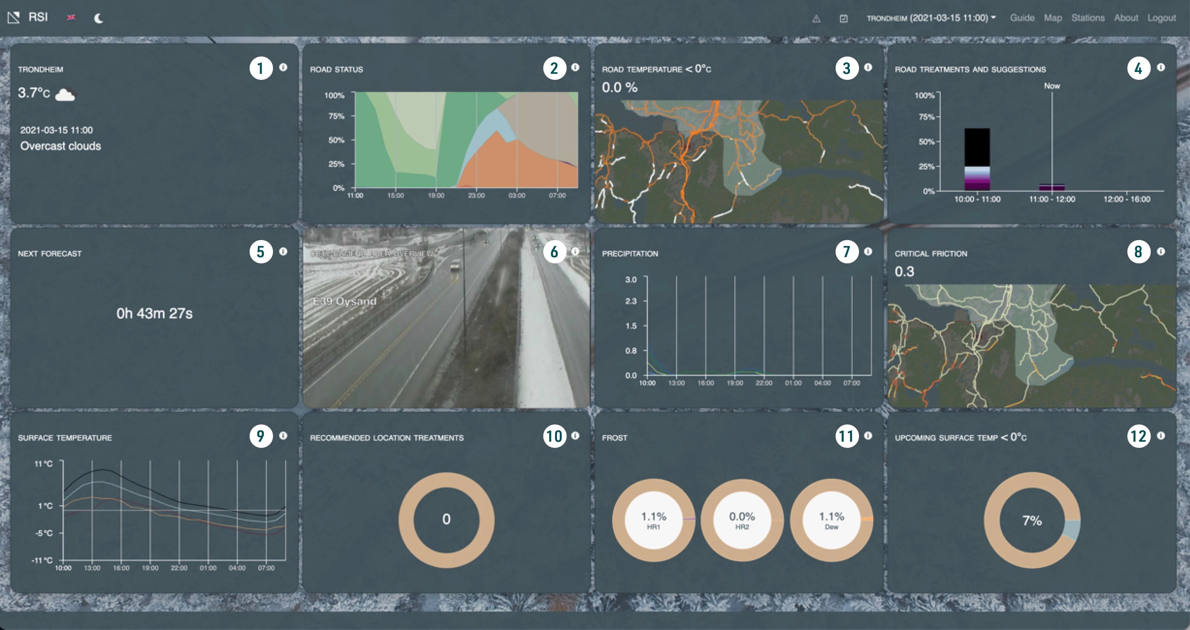
It should be easy to get an overall view of the coming hours. That’s why RSI has a dashboard function that makes it easy for users to see whether or not there is a risk of slippery conditions in the coming period. Whether you are working from your computer, mobile phone or tablet, it’s easy to get an overview quickly in order to determine whether you need to look more closely at the system. In the image of the dashboard above, you can see, for example, the following:
Picture 2) how much of the road network is at risk of slippery conditions developing
Picture 4) previous actions and suggestions for future actions
Picture 6) real-time data from weather stations with cameras
It looks like it’s getting slippery.
When users become aware that there is a risk of slippery conditions in the coming period, they can use RSI to create a detailed picture of what is to be expected.
The road status forecast provides an overall picture of what has happened in the past 24 hours and a detailed forecast for the next 18–24 hours. It takes into account previous actions and is also affected by floating car data where available.
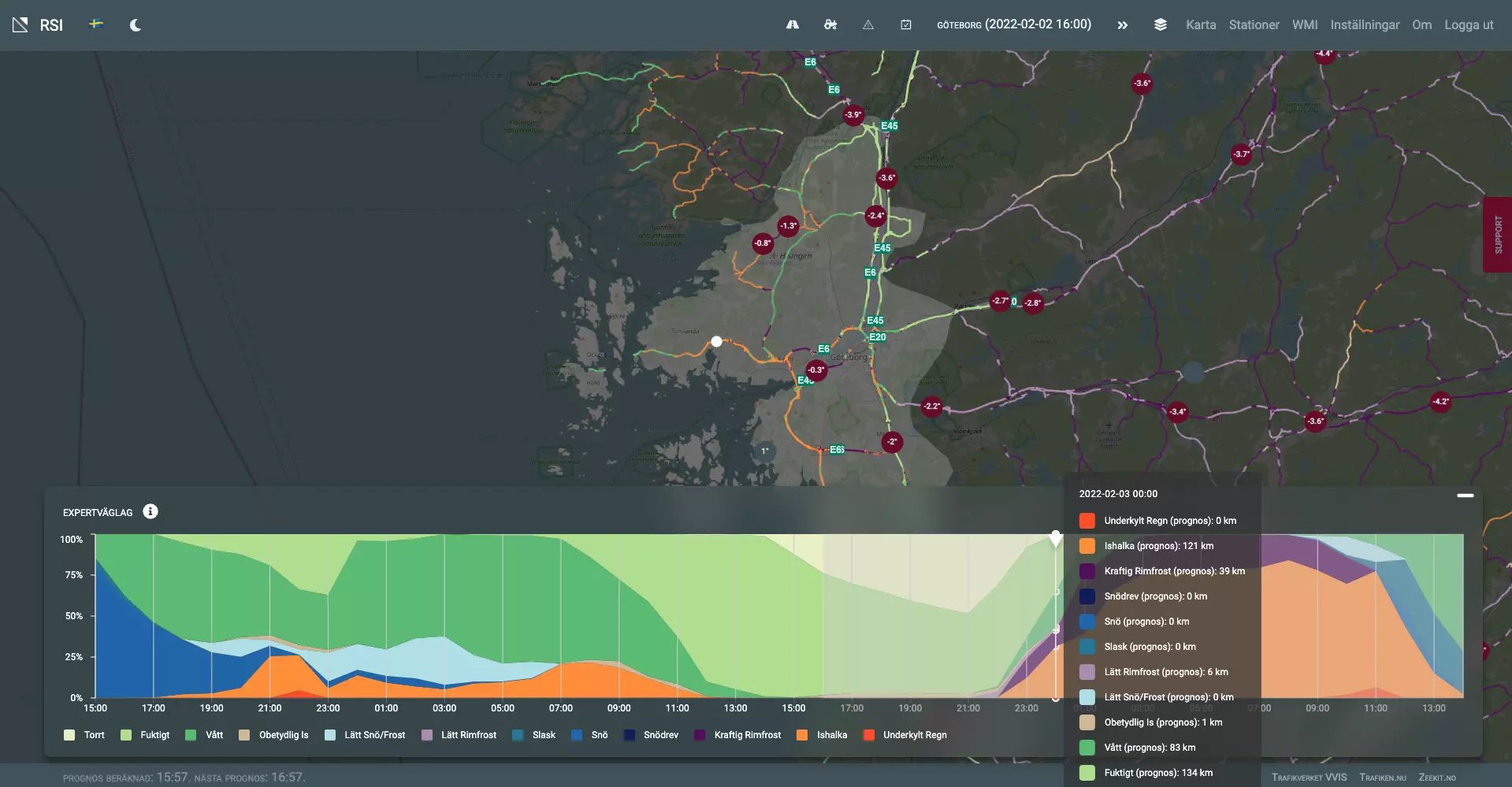
To further assist users, the action history and upcoming recommendations are available on the same screen. Recommendations are based on the forecast of slippery conditions and can be adapted to match the standard requirements and the equipment available. As an example, the start criteria for ploughing can be adapted to contract requirements and class of operation on the road network.
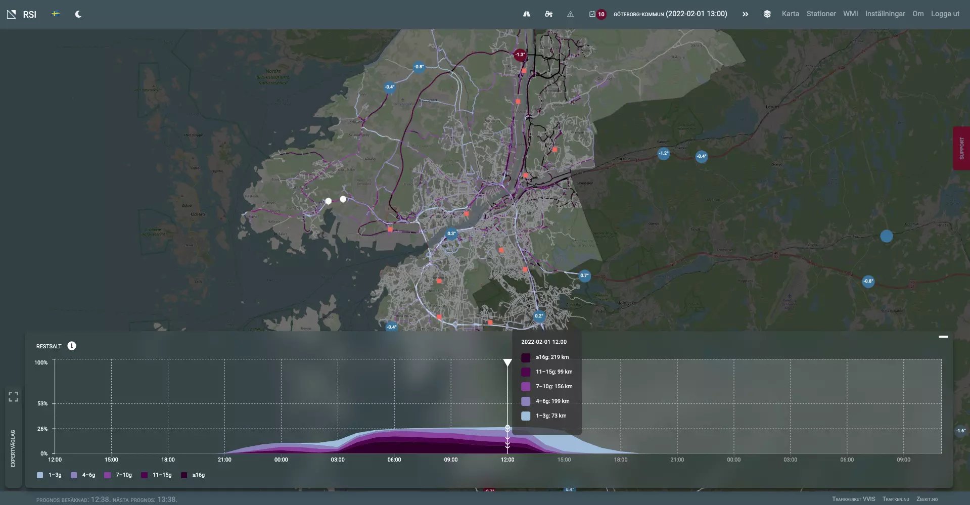
A frequent question when using salt is: how much salt is left on the road? With the help of RSI’s residual salt calculation, users receive additional help to consider their upcoming actions in the light of ones already taken.
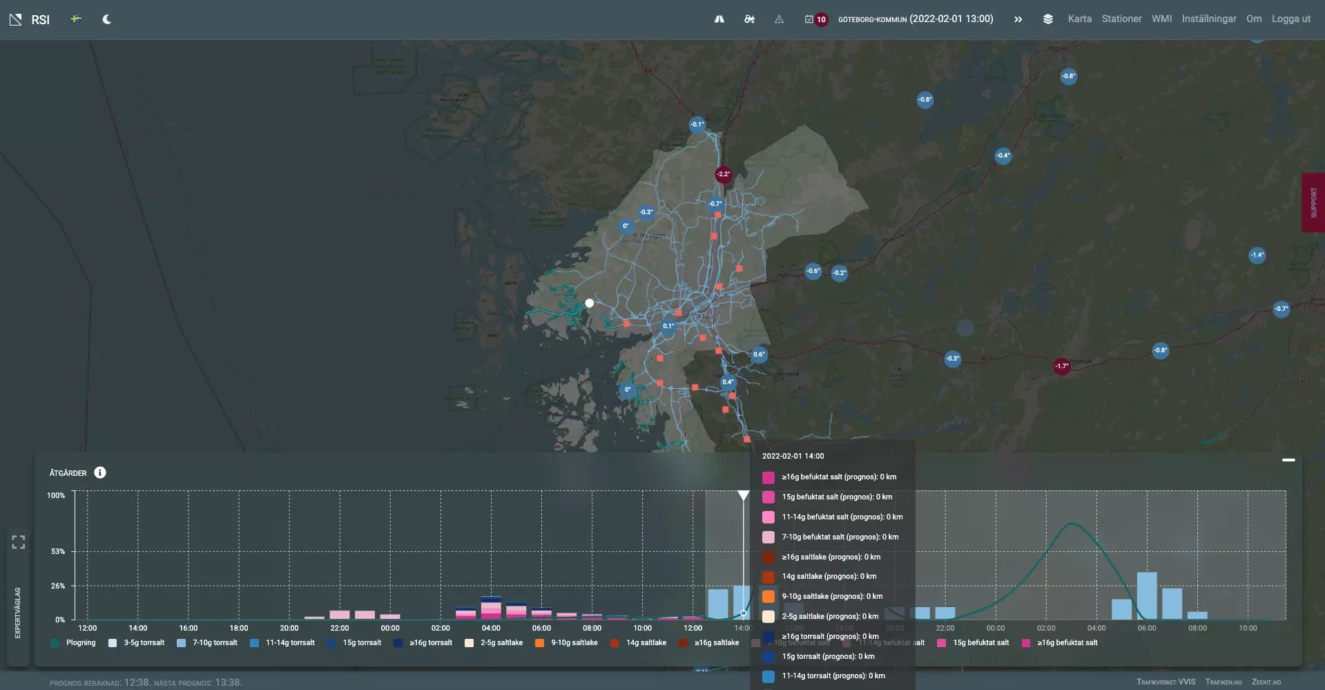
Once an action has been taken, it is sometimes difficult to know whether it has had the desired effect. The weather situation may have changed in ways that create uncertainty. That’s when access to different types of floating car data in RSI is so valuable. Essentially, different types of road status measurements are used in RSI. These measurements are visualised in the system and allow the user to monitor the road status during the day. These measurements are also used by the system to adjust the forecasts moving forward in order to obtain a more reliable forecast.
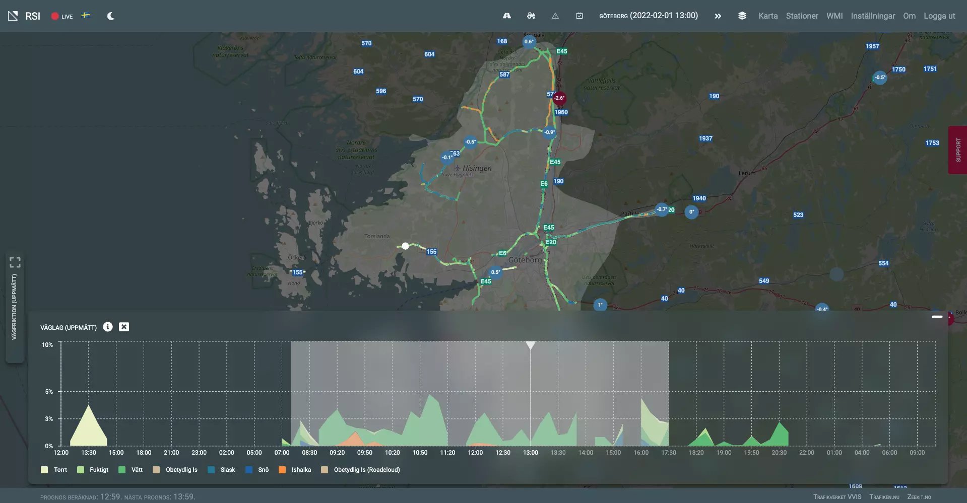
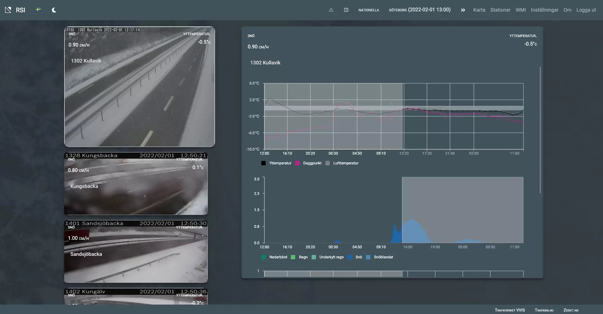
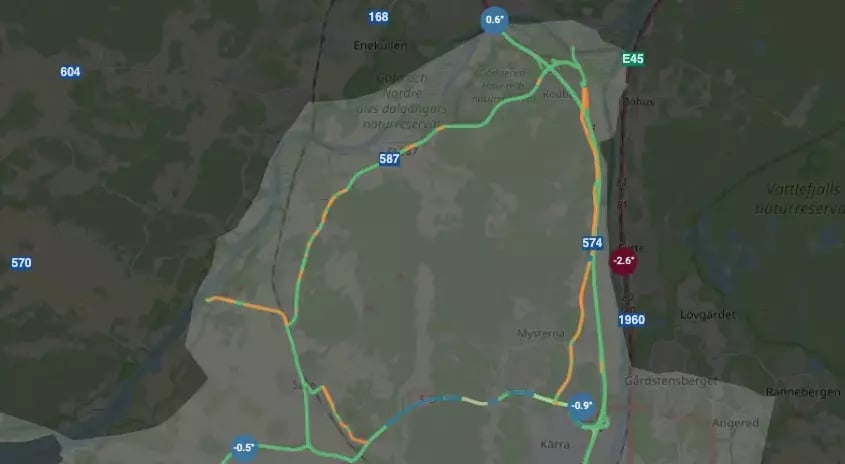
Users can zoom in and see in detail where it is slippery, or where snow has started to settle.
The image below shows the measurement data from laser sensors at the time in question.
Certain situations require that the emergency preparedness manager monitor the situation on an ongoing basis. RSI’s stations view shows all road stations in the area and makes it easy for the user to quickly scroll through the stations. This is especially helpful in the event of snowfall, as you can also quickly view the situation on the available road cameras to get a quick picture of how the snow is accumulating on roads in the area.